This was a flag station on the White Pass and Yukon route. This section of track was built about 1900.
Photos of the roadhouse and out buildings.
Building with photos of the inside including the ‘ceiling’
These guys are just too cute!
Emerald Lake
Dunes are the remains of an ancient glacial lake.
An old mine tipple beside the road
A Kiwanis statue near the Canada-U.S. border sponsored by clubs of both countries.
Skagway through the trees
We are headed to Whitehorse crossing bridges and rivers.
I saw this road sign for the first time in the Northwest Territories.
Five Finger Rapids – to which there is a hike that we did not take.
We spent the night at Montague Roadhouse..
Miles Canyon south of Whitehorse.
The view – now why couldn’t the moose be there this morning!?
Our first task was to go back to Eagle Plains for a new tire. Done!
The emergency airstrip (AKA the road). This one was much wider than another one we saw and is near an oil rig.
LeRoy’s shot of the oil rig and housing
Back to scenery….mixture of sun, clouds and haze
What some of these mountains are made of
Some of these rocks looked so loose and if you pulled one, they might all come falling down
The pretty pinkish/purple fox weed (which can be harmful to animals) going to seed.
Just a little of today’s dirt…..wish the maid would come.
Not crazy about all the dirt, but really did enjoy this trip. Would not suggest making the ‘kamikaze’ run we did. If one didn’t want to go the entire way to Inuvik, I think the first 200 miles would give a good taste of the scenery.
Welcome to Inuvik.
Our first stop was the ‘igloo’ church. The information in Dawson City was that they gave tours at 10 a.m. each day and Sunday after Mass. Outdated information apparently because it wasn’t open. I was very disappointed.
Structures are built off the ground. These are LeRoy’s photos
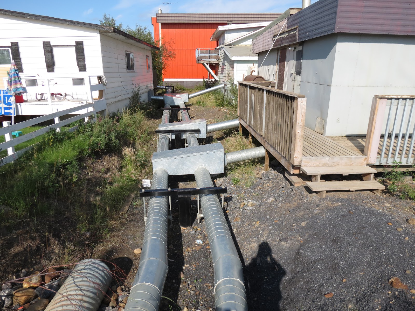
Utilities cannot be put underground so they are run through pipes (possibly stainless steel) – water, electric, sewer.
These two are LeRoy’s photos. Pretty neat and tidy.
My version in the business district
The colorful
This is the hospital
The MacKenzie Delta
Road being graded and watered down
Rengleng River
Time to cross the Pelly River again. This ferry is not free floating but is a cable ferry. The cable is just to the left of the deck.
As it nears shore, the cable comes out of the water.
Cable up the hill
As we approach the opposite shore
Back on the road
What road?
And back to the scenery
Rocks, rocks and more rocks but the ground cover makes them look so soft
We are back in the Yukon
Leaves are starting to turn.
Unusual diesel pump in Eagle Plain, but I’m told they had the same type set up in Central, Alaska
Fireweed going to seed at our campsite for the night
DUST!!! We had nothing like this going north, but southbound was awful.
This was where the fun began – we punctured the sidewall of a tire. We had just bought fuel 10 miles back. Everything is sooo dirty and the spare is under the truck. LeRoy changed the tire, I cleaned up some of the inside grit.
I had been glancing at the sun once in awhile as it was starting to set, but guess I should have watched closer. LeRoy happened to look out and there was a moose! Bad photo but....